contact us     advertise   site map  Bookmark and Share  
salida colorado

Contact Us
monty@salida.com

salida colorado directory

Best of Salida  - The Arkansas River

In the land of wicked whitewater, the Arkansas River reigns supreme. One of the most popular rafting rivers in the world, the Arkansas cascades through Chaffee County carving its way through the granite canyons of Chaffee, Lake, and Fremont Counties. The river runs for 1,469 miles, making it the 6th longest river in the country. It is also the second-longest tributary of the Missouri-Mississippi system.

The Arkansas begins as a small trout stream at the Continental Divide just south of Fremont Pass and from there plunges almost 5,000 feet in its first 125 miles. As it courses and sculpts its way through the lower valleys, it becomes a raging tempest in some areas, particularly during the spring snowmelt and in narrow river channels. Once out on the eastern Colorado plains, it mellows out and becomes a different river.

Beginning in the eastern Colorado-western Kansas region, the river is heavily utilized for irrigation, so much so that it now runs at a level less than one-fifth that noted in the 1960s! With depletion to this degree, it is almost surprising that the river makes it to its final destination, the river mouth at Napoleon, Arkansas.

arkansas riverThe Arkansas River Basin drains 24,904 square miles, making it Colorado's largest river basin. Major reservoirs throughout this basin include Pueblo Reservoir, John Martin Reservoir, Great Plains Reservoir System, Twin Lakes Reservoir, and Turquoise Lake. Major tributaries to the Arkansas include Fountain River and Purgatory River.

One of the reasons for the popularity of the Arkansas is that much of it flows through areas easily accessible by road, so the possibility of a put-in or a hired run are excellent. The whitewater can range from great to downright breathtaking. Finding an outfitter to navigate you through the river and its rapids is only a problem if they're all booked, as can sometimes happen during the peak season.

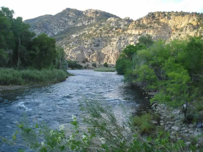
For those less inclined to experience the technically difficult and challenging areas, there are also stretches of the Arkansas that offer a little more peace and quiet if one is not up for thrashing the waves. Below Canon City, the river becomes noticeably more docile, allowing for an ideal family-friendly float between Canon and the Pueblo Reservoir. Still, it is best to keep in mind that despite the placid appearance of the river, hazards like submerged trees and occasional riffles can result in an unexpected swim. So, it is best to be prepared prior to a rafting outing.


Origins and Geology of the Arkansas River

The Sawatch Range of the Rocky Mountains was formed around 70 million years ago during the Laramide Orogeny (mountain building). A trough of late Paleozoic sedimentary rocks running through central Colorado was uplifted as a massive dome to create this mountainous range. Drainage off this range, then, created streams; these began flowing eastward, forming valleys. The Arkansas Valley is the northernmost of these valleys and conclusive geologic evidence establishes that this valley was formed no earlier than 29 million years ago.

Among the most outstanding features of the upper Arkansas Valley are the glacial characteristics of the topography throughout the area. Once the tectonic plate activity created new mountain ranges, glacial erosion served to sculpt these masses into their current forms. Today, glacial cirques and u-shaped valleys can be seen in connection with many tributary streams and side canyons in the valley. Rocky remnants of giant moraines are evident from Buena Vista to Salida, differentiating the upper Arkansas from other major rivers of the region.


History of the Arkansas River Valley

The Arkansas River is one of the most historically and economically important rivers in the United States. The first recorded crossing of the Arkansas River at the ford of the later Taos or Trappers Trail was made by the Spaniard Ulibarri in 1706. Ulibarri was in command of a force comprising 20 soldiers, 12 settlers, and 100 Indian allies, all marching from Santa Fe to rescue a band of enslaved Picuris from the Cuartelejo Apaches of present-day eastern Colorado. The Spaniard called the Arkansas the “Napestle” for its muddy color.

Native Americans hunted along the length of the Arkansas and early explorers followed it westward. The first man to explore the upper reaches of the Arkansas was probably Zebulon Pike in 1806 when he led an expedition west of Pike's Peak. On that trip and over the mid-winter period, he camped next to the Arkansas River at Squaw Creek, about four miles north of Poncha Springs, where a historical marker is now located. Pike was followed by General John C. Fremont, who also explored the upper Arkansas. From 1820 to 1846, the River formed the boundary between the United States and Mexico. It was named for the Arkansas Indians of Oklahoma and Kansas, states through which the river flows.

The Arkansas River has three faces. It is initially a wild mountain stream full of rapids and, in Colorado, provides some of the best white water rafting in the country. It is part of the old Santa Fe Trail through Kansas, where it is transformed into a typical braided prairie river meandering across the flatlands. Then, further south and into Oklahoma and Arkansas, it becomes a significant river for barge traffic as well as for recreation. From there it travels through hardwood forests and empties into the Mississippi at Napoleon, Arkansas.


Arkansas Headwaters Recreation Area

Stretching for 148 miles from Leadville through Chaffee and Fremont Counties to the Pueblo Reservoir, the Arkansas Headwaters Recreation Area is a unique park managed by both the Colorado Division of Parks and the U.S. Bureau of Land Management. Within the park are numerous recreation sites--some improved and some not. Since this is a new park, it remains a work in progress with projects such as its Watchable Wildlife area at Five Points in Fremont County. The Park system includes sites in Fremont County at Pinnacle Rock, Five Points, and Lone Pine as well as sites in Chaffee County including the following: Railroad Bridge, north of Buena Vista; Fisherman's Bridge and Ruby Mountain near Nathrop; Hecla Junction between Nathrop and Salida: and Rincon, southeast of Salida.


arkansas riverA Day on the Arkansas River Draws to a Close

After a thrilling whitewater adventure or fishing trip on the Arkansas River head to one of Salida’s best restaurants to complete your Colorado mountain-high experience. Depending on the day of the week, and on the events happening around town, you may need to make reservations ahead of time. At least for the more popular restaurants, that is. But then again, a short wait may be just enough time to stop by an art gallery in Salida’s historic downtown or perhaps do some window shopping and people watching. Take a look at our Dining section where you will find information on some of Salida’s best restaurants.

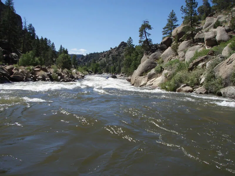
Hopefully, you will have already made your Salida lodging reservations so that you can retreat to your motel room for some well-deserved rest and relaxation before heading out for yet one more Colorado Rocky Mountain adventure! If not, there are plenty of Salida lodging facilities to choose from and lots of amenities, too. Hot tub soak or hot springs experience? Many of Salida’s lodging properties have hot tubs and spas as well as coupons for Mt. Princeton Hot Springs. Complimentary breakfast in the morning? Again, quite a few offer this as well. Although, you just may want to get another dose of the Salida experience by enjoying breakfast at the Patio Pancake Place on Highway 50, a diner that is popular with locals for their hearty breakfast choices and lunch menu.

salida news at ark valley voice

Monarch Mountain

high country bank

Salida advertise

See what others have to say about Salida.
trip advisor

salida colorado directory salida colorado directory salida colorado directory
photo gallery video gallery

All content ©1998-2020 Salida.com and Monty Holmes-monty@salida.com. Content written by Rita Washko (RMW Enterprises), technical and science writer.